Хочете будувати кар’єру в Data Science та AI? Vodafone Big Data Lab відкриває новий набір —>
Олександр КузьменкоWar
22 October 2026, 11:56
2026-10-22
“What if Russia occupied 20% of your country?”. A Georgian couple created an interactive map that shows foreigners the extent of the occupation of Ukraine
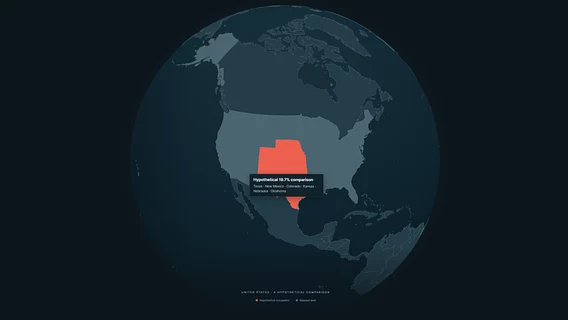
An IT couple from Georgia who survived the Russian aggression in 2008 created an interactive web project called Russian Occupation. The tool allows foreigners to choose their own country and see what losing 20% of its territory would look like.
An IT couple from Georgia who survived the Russian aggression in 2008 created an interactive web project called Russian Occupation. The tool allows foreigners to choose their own country and see what losing 20% of its territory would look like.
The project’s authors, Nina and Levan, announced their initiative in a post on Reddit. According to them, Russia has occupied a total of about 125,000 km² of the territory of Ukraine, Georgia, and Moldova, which is approximately half the size of Great Britain.
“We created this website to help people understand the scale of the occupation through places they know. The size of the territory cannot measure the lives lost, the forced displacement, or the repression, but it helps to understand: these are not just lines on a map. These are homes, cities, and people’s lives,” Levan and Nini note.
For clarity, the service models a red zone of occupation on the Earth’s surface, attempting to recreate a continuous territory along the border or coast of the selected state. The creators emphasize that the hypothetical 20% for other countries is only an illustration and is not a military forecast.
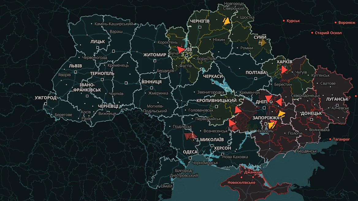
The section dedicated to the history of Russian occupation covers events in Moldova since 1992, Georgia since 2008, and Ukraine since 2014. To reflect the dynamics of a full-scale invasion, the developers used archival data from the analytical project DeepState. The map clearly emphasizes that temporary occupation does not change sovereignty, and Crimea, Donbas, Abkhazia, South Ossetia, and Transnistria remain legitimate parts of their states.
A map of energy independence of buildings has been launched in Ukraine. It will be able to show whether a building will have water, heat, and internet without electricity