Хочете будувати кар’єру в Data Science та AI? Vodafone Big Data Lab відкриває новий набір —>
Наталя ХандусенкоHot News
23 September 2026, 15:37
2026-09-23
A Ukrainian created a BlindDriver navigator that doesn't get lost when the GPS is muted
Serhiy Yarovoy, Business Process Optimization Manager at Wise IT Ukraine, created BlindDriver, an application for stable navigation in conditions of active electronic warfare (EW) when the satellite signal disappears or shows incorrect data.
Serhiy Yarovoy, Business Process Optimization Manager at Wise IT Ukraine, created BlindDriver, an application for stable navigation in conditions of active electronic warfare (EW) when the satellite signal disappears or shows incorrect data.
According to Serhiy Yarovy, the main goal of BlindDriver is to provide continuous route guidance even when traditional navigators become useless.
"Do you like driving in unfamiliar places under electronic warfare? When your smartphone is in Lima, the dot in the navigator doesn't move at all... I don't. Therefore, Android owners can rejoice and try my new navigator Blind Driver, which uses phone sensors and cellular data to link your car to the route you have planned," notes Serhiy Yarovoy.
How BlindDriver works
The main difference between BlindDriver and standard mapping services is that it does not blindly trust every GPS position. The application analyzes the quality of the satellite signal, the level of receiver gain (AGC), speed discrepancies and coordinate jumps. If the signal is recognized as unreliable or jamming is detected, BlindDriver switches to autonomous calculation mode:
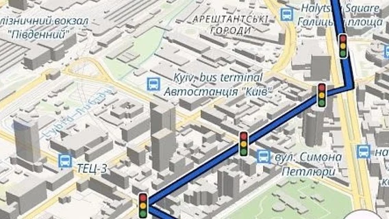
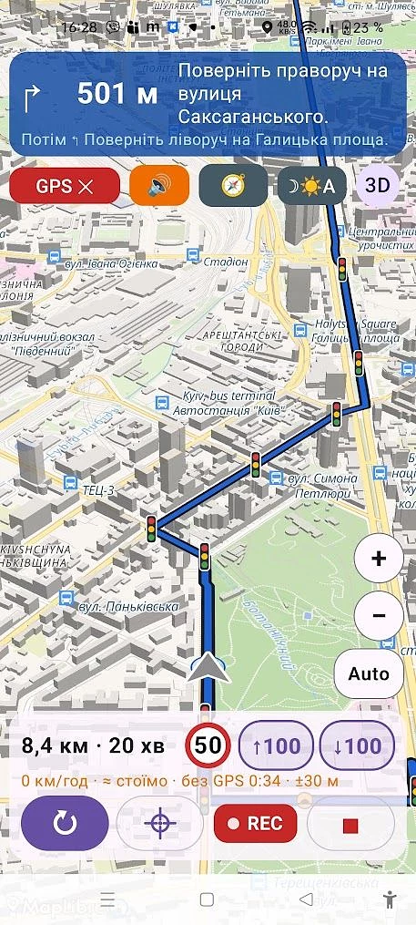
Sensor and network estimation: The marker continues to move along the route using the smartphone's internal sensors (accelerometer, gyroscope) and data from cell towers and Wi-Fi. This allows it to take into account stops at traffic lights and turns.
Status indication: The screen displays the exact signal status (from normal to complete jamming), as well as the range of possible error.
Manual correction: For cases where error accumulates, the “↑100” and “↓100” buttons are provided, which allow the driver to move the marker 100 meters forward or backward along the route with one touch.
"By the way, the route can be built autonomously, even without a mobile connection (maps and addresses are downloaded upon request). And even photo cameras are already marked. And there are also buttons for manually adjusting your location on the route," the developer adds.
Autonomy and functionality
Starting with version 0.1.7, BlindDriver has a full offline mode. Users can download the road graph of Ukraine (about 287 MB) and offline address directories by region to search for streets and build routes without internet access.
Additional features of the application include:
voice prompts in Ukrainian with correct cases;
built-in database of 426 cameras of the Patrol Police of Ukraine, which works without a network;
traffic light and speed camera warnings;
saving your own trip tracks to create individual routes ("how I drive").
The application is being developed for the Android platform (version 10+) and is currently available for installation via APK file. At this stage, the project is in active testing formats.
"Use it until I ask for money. I only ask you to share logs where the navigator made a lot of mistakes, or vice versa - you drove with a lot of turns, junctions and the GPS worked well (it helps in simulations)," Serhiy Yarovoy concluded.
A detailed description and download links are available on GitHub .
Don't miss your station. The developer has launched an iOS application for the Kyiv metro. How is it useful for people who don't want to track their trip on their own?
Круто, що тема рухається — глушіння давно стало буденністю, і чим більше рішень, тим краще. Додам від себе: я розробник Azimut GPS, ми теж робимо захист від глушіння й підміни. Застосунок є в Google Play, базова функція безкоштовна. Коли GPS глушать, Azimut сам підставляє позицію в Waze, Google Maps і Android Auto — нічого не треба вмикати вручну. Буду радий відгукам: https://play.google.com/store/apps/details?id=app.azimutgps










Круто, що тема рухається — глушіння давно стало буденністю, і чим більше рішень, тим краще. Додам від себе: я розробник Azimut GPS, ми теж робимо захист від глушіння й підміни. Застосунок є в Google Play, базова функція безкоштовна. Коли GPS глушать, Azimut сам підставляє позицію в Waze, Google Maps і Android Auto — нічого не треба вмикати вручну. Буду радий відгукам: https://play.google.com/store/apps/details?id=app.azimutgps