Vantor (ex-Maxar) launches space 3D mapping for drones and the military
Vantor, formerly known as Maxar Intelligence, has introduced WorldView 3D, a service that allows users to receive highly accurate three-dimensional maps of the planet directly from space in a matter of hours. The new technology is aimed at the defense sector, tactical mission planning, as well as drone navigation in conditions of complete absence of GPS signal.
Vantor, formerly known as Maxar Intelligence, has introduced WorldView 3D, a service that allows users to receive highly accurate three-dimensional maps of the planet directly from space in a matter of hours. The new technology is aimed at the defense sector, tactical mission planning, as well as drone navigation in conditions of complete absence of GPS signal.
The launch of the service was reported by SpaceNews, citing company representatives.
The new WorldView 3D product line consists of two solutions. The first, WorldView 3D Rapid, allows you to quickly receive updated three-dimensional maps with a resolution of 50 cm within 24 hours from the moment of shooting and an accuracy of up to 4 meters. The second, WorldView 3D High Definition (HD), is focused on maximum detail and provides a unique accuracy of 3 meters at a resolution of 15 cm.
«WorldView 3D is all about efficiency. With the click of a button, you can see what the world looks like in 3D,» said Vantor Product Director Peter Wilczynski.
He added that one of the main technological challenges of the project is to connect modern artificial intelligence models, which are usually not three-dimensional, with real physical space for the automation of analytics and robotics.
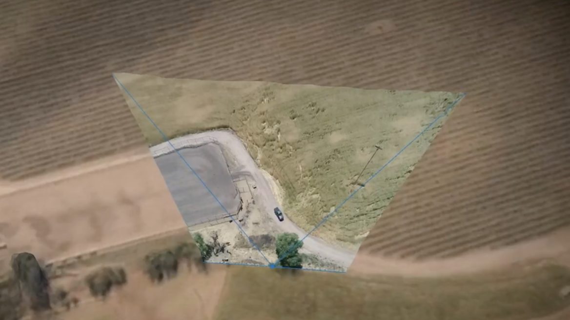
Of particular note is the integration of the technology with another product of the company — Raptor. This is a navigation system for drones based on terrain in conditions of blocked satellite signal systems. According to the developers, operators can quickly collect 3D data from orbit, process it, upload it to the drone, after which the device is able to perform autonomous flight even with significant changes in the environment or under the influence of electronic warfare.
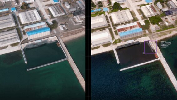
To demonstrate the capabilities of the technology, the developers provided up-to-date satellite images from June 28, 2026. In particular, they show in detail the underwater base in Sinpo (North Korea) with a submarine and a test barge for ballistic missiles, as well as the construction of a Chinese aircraft carrier at a shipyard in Dalian.
Interestingly, the development of such GPS-free navigation systems has come from an unexpected source:the popular mobile game Pokémon Go. For years, its players have scanned the environment for virtual bonuses, and now this data has found military applications. About 30 billion 3D scans of the real world, voluntarily uploaded by users, have become the basis for training artificial intelligence, which will help combat drones and ground robots accurately navigate in space in conditions of complete absence of GPS signal or active operation of enemy electronic warfare equipment.
The developer of the original game, Niantic, sold its gaming division along with Pokémon Go to Saudi company Scopely for $3.5 billion in 2025. However, the giant database of accumulated spatial data remained in the ownership of the American company Niantic Spatial, which separated after the deal. In late 2025, the company announced a partnership with Vantor. The goal of the collaboration is to create a visual positioning system (VPS) that can completely replace satellite navigation.
At the same time, Vantor denies that player data is directly uploaded to drones, while Niantic Spatial claims that the array of scans was used exclusively to train an early version of their own AI model.
As a reminder, the Vantor brand was formed after the restructuring and rebranding of satellite giant Maxar Intelligence in the fall of 2025. The company has deep roots in 3D technologies thanks to the acquisition of Vricon, a company specializing in three-dimensional geospatial analytics, in 2020. Rapid processing of large data sets in WorldView 3D was made possible by updated proprietary reconstruction algorithms and a constellation of six WorldView Legion satellites launched during 2024–2025.
WorldView 3D images taken in Paris, France, showing famous areas of the city at a resolution of 15 cm. Image: Vantor
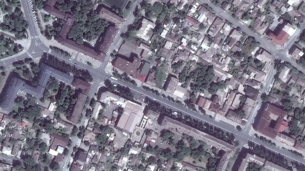
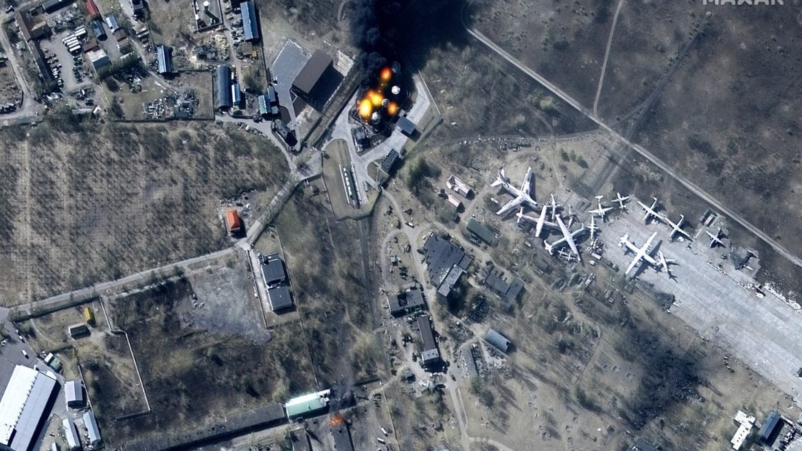
The company’s images later became key evidence of the occupiers' war crimes: they documented mass graves in Bucha during the occupation of the city, the destruction of the Mariupol Drama Theater with the inscription «CHILDREN» and the consequences of strikes on Zmiiniy Island. Maxar’s satellite data actively helped the Ukrainian Defense Forces plan operations and assess damage to enemy targets.
Космічні амбіції в Давосі, мільярди супутниковим операторам, 59 друзів Ілона Маска, місячні плани Китаю та інші новини космічного тижня
Щосуботи ми готували для вас із любов’ю традиційний дайджест космічних подій України та зарубіжжя. Але зараз наша любов та безмежна повага — Збройним силам України та бійцям територіальної оборони, які героїчно відстоюють незалежність нашої країни. Слава Україні!
Війна космічних престолів, Starliner своїх ще візьме, аванпости на орбіті та інші події Space Tech тижня
Щосуботи ми готували для вас із любов’ю традиційний дайджест космічних подій України та закордоння. Але зараз наша любов та безмежна повага — Збройним силам України та бійцям територіальної оборони, які мужньо боронять незалежність нашої Батьківщини. Слава Україні!
Святковий донат ЗСУ, космічні дані оцінюють військові збитки, зростаючий фактор кіберзахисту та інші space-tech події тижня
Щосуботи ми готували для вас із любов’ю традиційний дайджест космічних подій України та зарубіжжя. Але зараз наша любов та безмежна повага — Збройним силам України та бійцям територіальної оборони, які віддають свої життя у боротьбі за незалежність нашої країни. Слава Україні!
Have important news to share? Message our Telegram bot
Key events and useful links in our Telegram channel