Наталя ХандусенкоAI Eng
21 July 2026, 15:59
2026-07-21
A Ukrainian military man has developed a program for working with coordinates — instant conversion, quick viewing, and mass marking. How the Stepan system works
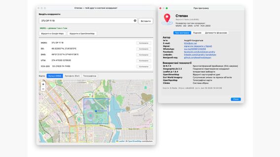
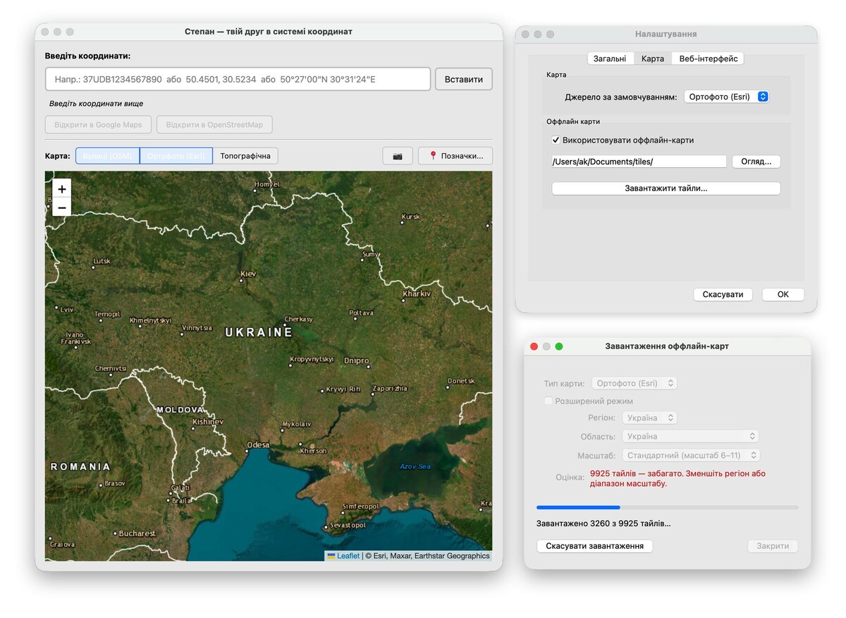
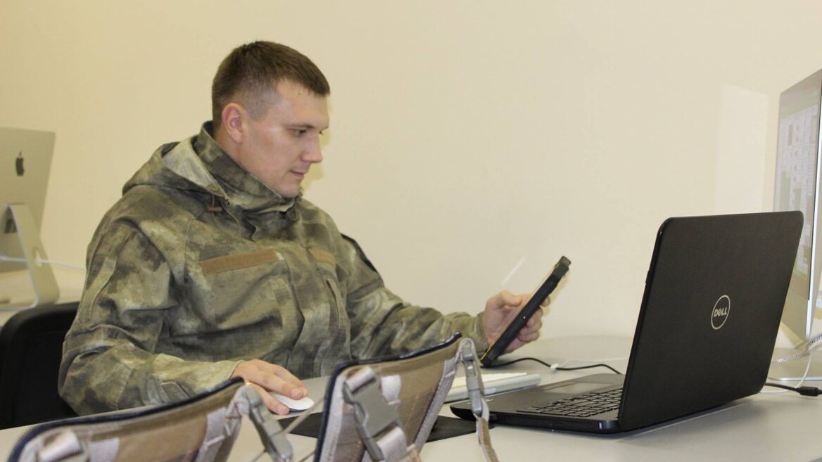
While most military software solutions require lengthy authorization, deployment, and specific devices, seconds often play a decisive role on the front. The first public beta version of the cross-platform application "Stepan" was recently released. This is a lightweight tool created for one clear task - instant processing and visualization of military coordinates of any format. The creator of the system is Andrey Kondratyev, a military serviceman and IT specialist with many years of experience.
While most military software solutions require lengthy authorization, deployment, and specific devices, seconds often play a decisive role on the front. The first public beta version of the cross-platform application "Stepan" was recently released. This is a lightweight tool created for one clear task - instant processing and visualization of military coordinates of any format. The creator of the system is Andrey Kondratyev, a military serviceman and IT specialist with many years of experience.
From need to idea
The idea to create his own converter arose directly from combat experience. While serving in the 24th Separate Mechanized Brigade, Andriy regularly had to work with specific military coordinates that ordinary mapping services simply did not recognize.
“I often worked with coordinates that Google Maps or other similar services don’t understand at all,” recalls Andriy Kondratyev . “I found some resources on the Internet, but they were very crooked, crude, and inconvenient. I wanted to have a tool at hand where you could make two clicks and immediately see on the map the point of enemy UAV training, a mining point, or a planned target. To understand me, try to quickly look at the coordinate 37U DP 11286 19318 on the map. With “Stepan,” it takes me up to 5 seconds.”
The chance to realize the idea appeared when Andriy was transferred to a permanent deployment point for half a year to form a new military unit. Free time appeared, which was previously sorely lacking, and the accumulated experience turned into working code.
The developer solved the name issue with a light humor: "I'm not very good at normal names - I could only come up with something banal like CoordinateConverter. The name came up while watching the news from Poland. I decided to call it "Stepan". Why? Because Stepan is our guy!".
How Stepan works and how it differs from Delta and Nettle
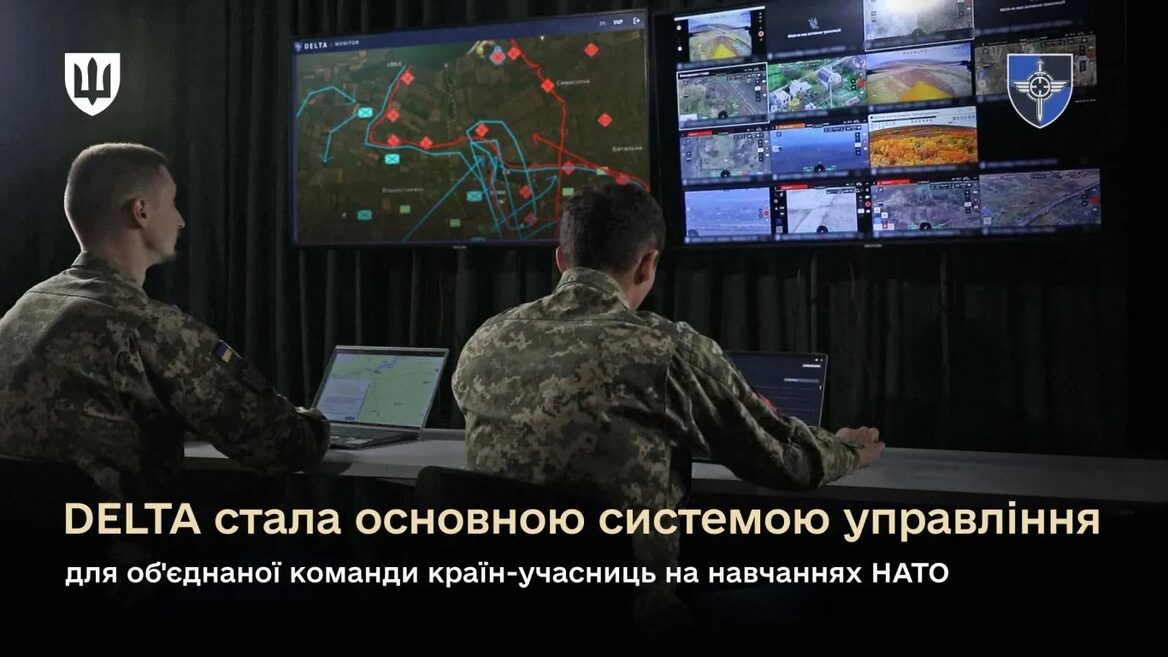
Unlike large-scale situational systems like Delta, Nettle, or MilChat, Stepan doesn't try to be everything at once. It's a standalone desktop application that simply does its job without unnecessary bureaucracy.
“The main difference is the desktop cross-platform program that simply works without the need to log in,” explains Andriy. “Delta is convenient, but it works via the web, and not all military personnel have an account there. To check one coordinate, you need to log in, perform a series of actions, and only then see the MGRS point. It’s a similar story with “Kropyva”, and besides, it’s not a desktop. I’m not a “tablet” user, I needed an app for a PC: I copied, pasted — and immediately got the point on the map.”
In addition to a convenient graphical interface, Stepan offers the following features:
Console mode (CLI): allows you to use the tool on servers or in bash scripts for bulk data processing.
Own Web server: the application can accept GET records and return JSON, which is convenient for integration with bots.
Intelligent recognition: the system itself determines the input coordinate format — whether it's MGRS, the outdated USK-2000, or other variations. You can "feed" the program even a million lines of different colors, and it will reduce everything to a single form.
Launch and first results
The official public release took place on June 20, although the basic version was ready in May. During the first month, the developer released 4 updates with bug fixes and improved functionality.
Andriy intentionally does not know the exact number of users — and this is a conscious position on security: “The program does not collect any statistics or telemetry and does not send anything anywhere. Therefore, I do not know the statistics, but at least one person definitely uses it — it is me. I am also the main tester for now, fortunately, my experience as a Senior QA in the past still makes an impression.”
The role of AI and the tech stack
The project development took about six months. Since Andriy wanted to create a truly cross-platform tool, the idea of writing exclusively for macOS (in Swift) or creating only a console utility in Python had to be abandoned.
The basis of the technology stack was formed by:
C++ and Qt: a fundamental choice for cross-platform (Windows, Linux, macOS).
GeographicLib: geodetic transformations and mathematical calculations of coordinates.
Leaflet.js & map services: visualization using OpenStreetMap, Esri World Imagery, and OpenTopoMap.
There was also a place for artificial intelligence in the development. Andriy used the Claude neural network for routine and infrastructure tasks: “Claude wrote the main page for GitHub Pages, set up CI/CD, which checks compilation on different platforms, performs Smoke tests, and deploys artifacts. He also helped me debug several complex modules where I got stuck, and suggested where to look for hidden bugs in the code.”
Future plans
Currently, the developer's main focus is on polishing the system and fixing minor flaws.
“I have already implemented the basic functionality that I needed for my work,” Andriy Kondratyev concludes. “In general, I plan to continue fixing bugs. If users find an error or have an idea for a new feature, there are special items in the menu “Report a bug” and “Suggest a feature,” which lead to GitHub. Also in the near future are plans to sign the application with official developer certificates so that Windows and macOS can open it without additional security system warnings.”
Ukrainian developer invested over $100,000 in MilTech applications that the Armed Forces of Ukraine have been using for 10 years. How TacticMap and MyGun, which entered the TOP-3 of the AppStore, work
"Thanks to the Nettle, we have one of the most accurate artillery systems in the world." "Army SOS" created software for the army that helps hit enemy targets
Як нейромережі бачать вільну та незалежну Україну? Тест dev.ua
Нейронні мережі для генерації зображень бачать світ по-своєму, їхню логіку зрозуміти часом зовсім неможливо. Але таки хочеться. На честь Дня Незалежності України редакція dev.ua вирішила провести невеликий експеримент.
Ми задали чотирьом різним нейронним мережам п’ять однакових запитів: «прапор України», «День Незалежності України», «український Крим», «перемога України» та «українці». Отриманими результатами ми ділимося з вами нижче.
У TikTok тепер можна генерувати фон за допомогою нейромережі. Ми протестували її та ділимося результатами
У TikTok з’явилася нова функція «Розумний фон». З її допомогою як фон для тіктоків можна підставляти згенеровані нейромережею зображення. Редакція dev.ua протестувала цю технологію і ділиться своїми враженнями.