Наталя ХандусенкоStartup
8 October 2026, 11:11
2026-10-08
A Kharkiv IT professional has developed an application to combat coordinate substitution and navigation jamming: Azimut GPS automatically protects Waze, Google Maps, and Android Auto
System administrator Timur Morozov developed a specialized Android application Azimut GPS, which detects problems in satellite navigation and transmits the user's real coordinates directly to Waze or Google Maps.
System administrator Timur Morozov developed a specialized Android application Azimut GPS, which detects problems in satellite navigation and transmits the user's real coordinates directly to Waze or Google Maps.
Prehistory
The idea for creating the application arose from the developer's own experience during trips to Ukraine and a stay in a front-line city, where the satellite signal is constantly disrupted due to the operation of electronic warfare (EW) equipment.
I often travel around Ukraine and encounter GPS problems. It is especially inconvenient when it happens in an unfamiliar city: you approach an intersection, and the navigator shows a completely different place. I wanted to continue using my usual navigator even in such conditions. This is how Azimut GPS grew out of it. I live in Kharkiv, and here the navigator regularly shows that I am in Lima
In the summer of 2026, the developer began to study the behavior of a smartphone during GPS failures. He noticed that during signal jamming or substitution, the device could see satellites, but the GPS system time began to differ from the actual one by hours, and the location point was “moved” thousands of kilometers from the real coordinates recorded by the surrounding networks. It was these discrepancies that formed the basis of Azimut’s algorithms.
How Azimut GPS works
The application runs in the background and automatically turns on protection when movement begins. The principle of its operation consists of several stages:
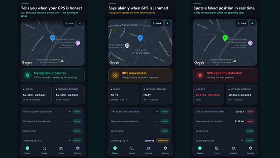
Azimut compares the number and strength of satellites, the time and change of position with the location data from surrounding networks. This allows you to clearly distinguish between jamming (the presence of satellites without a position determination) and spoofing (false position).
The application substitutes the real position determined by networks and transmits it to Waze or Google Maps through standard Android mechanisms.
The protection works on car screens. In addition, since October 8, the Azimut navigator has also been operating in the Android Auto environment.
When the jamming stops, the application automatically detects the signal recovery and returns to using the real GPS.
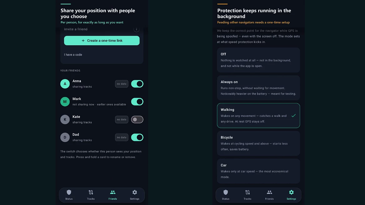
“It was important to me that after that I wouldn’t have to give up my usual route in Waze or Google Maps. Azimut can transfer the position to them via the standard Android mechanism. This requires a one-time setup. This already works when Waze or Google Maps are open on the car screen via Android Auto. When GPS works normally again, the navigators return to it,” the developer explained.
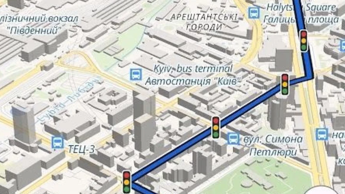
Azimut also has its own full-fledged navigator with Ukrainian voiceover, tips on lanes, cameras, speed limits, and taking into account traffic jams in Ukraine.
Launch and first results
The application appeared on Google Play in late August 2026 after a closed testing period. According to the developer, as of October 2026, the monthly audience of the service is about 1,250 active users (~570 per week).
Approximately 90% of the audience is concentrated in Ukraine, there are also users in Israel. The interface is translated into 8 languages, and basic protection is completely free and does not require registration.
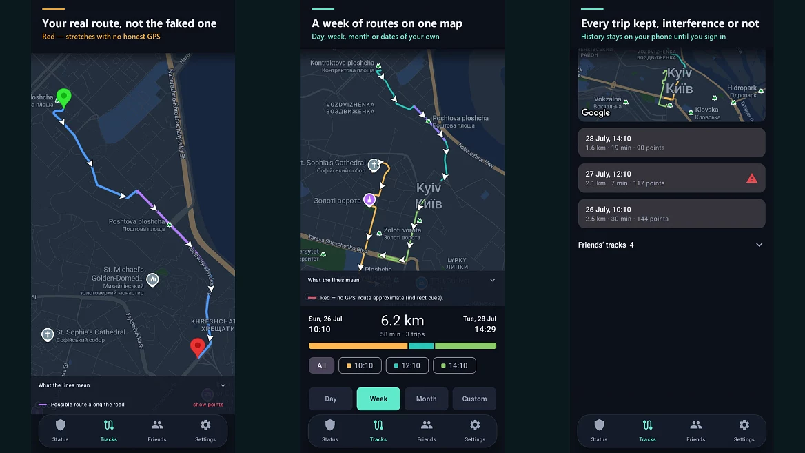
As Morozov notes, new features are constantly tested on real trips with friends and acquaintances: "I test new features on trips with friends and acquaintances who help test the application. We also measure the performance on recorded routes. Recently, during a trip under jamming, the protection turned off by itself after ten minutes: the application decided that the car was stationary because there was no GPS position. We found this in the trip recording and fixed it in the next update."
Tech stack and AI
Azimut is designed for Android with its own server. Maps, routing and navigation are built on open source software and OpenStreetMap data without the use of commercial mapping products.
During development, the author actively involves artificial intelligence as an assistant: “I use AI as an assistant: it checks the code before each release, looks for errors, and helps me choose the right direction in complex technical issues. The solution, architecture, and testing are my responsibility. We first test each new feature on real trips — me and a group of friends and acquaintances who are testers — and measure it on recorded routes. Only after that does it go to users.”
Development plans
The new app update is currently being tested on Google Play. Among the announced features and upcoming innovations:
Using the car's GPS: in cars with their own GPS, the application will use the car's data during jamming.
Assistant phone: the ability to use an old smartphone in a car for more accurate position determination during electronic warfare.
Updated interface: simplified home screen and step-by-step setup wizard.
Waze integration: the ability to open routes shared on Waze.
Own congestion database: anonymous collection of data about slow areas to display congestion in places where information from other services is missing.
You can learn more about all the features of Azimut GPS on the project website . The application is available on Google Play , and you can discuss its work in the Telegram community .